May showers alleviate some drought conditions on Colorado’s Western Slope, but can’t wash away water supply concerns
An El Nino pattern this summer could bring above-average precipitation to the southwestern U.S. but won’t be enough to pull Colorado out of deep drought

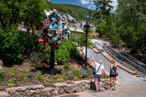
Austin Colbert/The Aspen Times
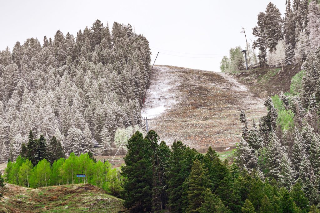
A period of wetter, cooler weather has slightly bolstered streamflows and reduced drought conditions in the Colorado mountains. Still, it won’t be enough to end concerns about water supply after a historically hot and dry winter.
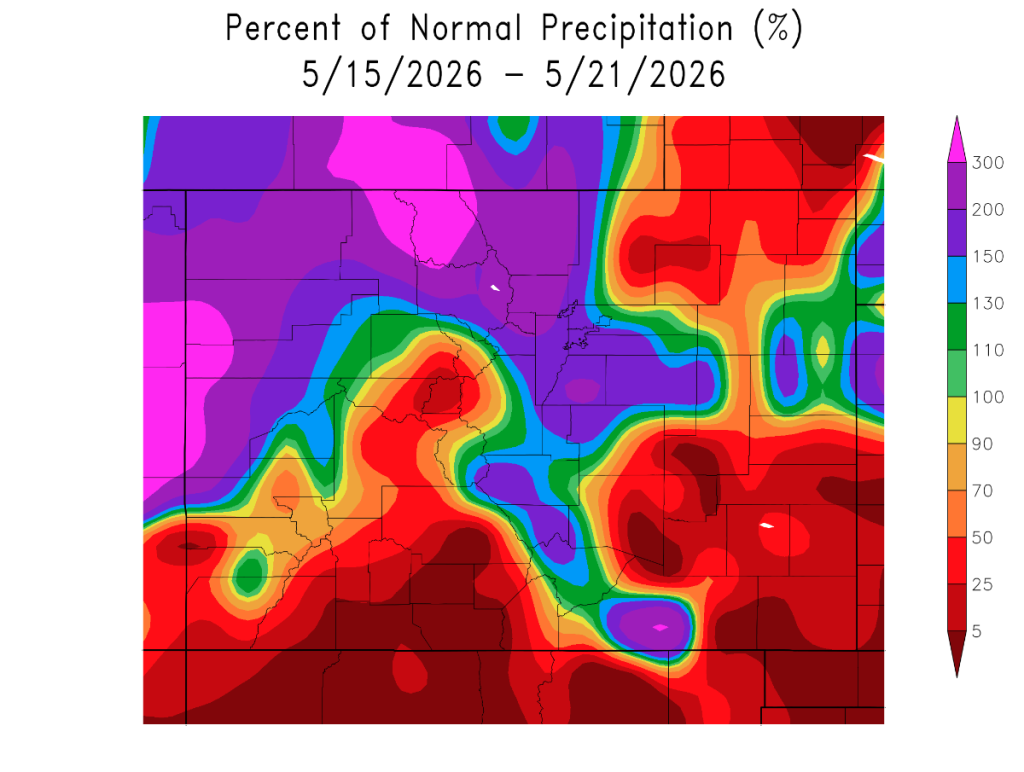
Over the past week, parts of northwestern Colorado — one of the most drought-stricken regions in the state — received above-average precipitation for this time of year, according to Colorado State Climatologist Russ Schumacher.
“May still tends to be a pretty wet time of year in normal years, so we expect to see these kinds of storms in May,” Schumacher said on Thursday, May 22. “But we also expect to see big snowstorms in March, and we didn’t get that this year. So it’s nice we’re having conditions that are a little bit more normal in May.”
Colorado experienced its worst snowpack on record this past winter, with a March heatwave that rapidly melted off what little snow remained at high elevations. Since the snowpack supplies up to 80% of the state’s annual water, the low snowpack has sparked widespread concerns about water supplies across the southwestern U.S.
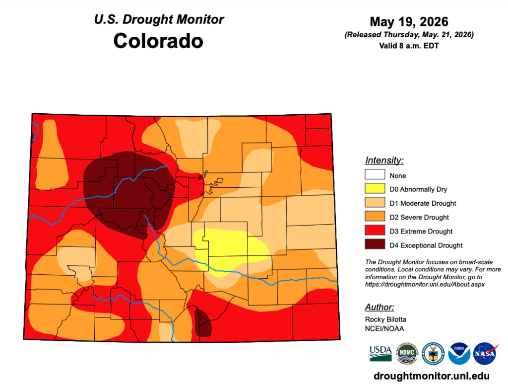
Since mid-May, much of Garfield, Rio Blanco, Moffat, Routt and Grand counties have received precipitation in excess of 150% of normal for this time of year, according to the High Plains Regional Climate Center. The latest U.S. Drought Monitor map published Thursday shows drought conditions improving slightly in many of these areas, dropping from exceptional (or Level 4 of 4) to extreme (or Level 3 of 4) in some areas.
Support Local Journalism
However, other parts of the Western Slope received less precipitation. In Summit, Eagle and Pitkin counties, precipitation over the past week ranged from about 50% to 130% of normal for this time of year. Exceptional drought persists throughout these counties, according to the Drought Monitor.
“In the mountains, it’s really tough now because so much of the water comes from the snow,” Schumacher said. “Certainly, a rainy summer would help to alleviate drought conditions, but in terms of streamflows or water going into reservoirs, it’s really hard for summer rains to make up for that because it’s not nearly as much water as you would normally get in the winter at high elevations from the snowpack.”
With the low snowpack, streams and rivers across the state have significantly less water than usual flowing through them. Peak streamflows in most Colorado rivers this year were the lowest on record or less than 10% of the historical average, according to the Colorado Basin River Forecast Center.
Schumacher noted that while the March heatwave had some people “freaked out,” the hot weather would result in streamflows peaking weeks early, in late March or early April. But periodic rain and snow in April and May has meant that most streams have seen another peak this spring.
The Eagle River, for example, saw water levels peak at about 4.95 feet in late March, but then saw an even higher peak of about 5.3 feet in May, according to the forecast center. The Colorado River in Glenwood Canyon also saw water levels rise amid the March heatwave, reaching a height of about 4.5 feet, then a peak in mid-May at about 5 feet due to precipitation in April and May.
With little snow left in the mountains to melt off, Schumacher said that an upcoming stint of warmer weather could eat away at the last of the snowpack and result in one final surge of water in the rivers.
“Maybe the good news for the holiday weekend is that some of the better flow conditions of the year might be this holiday weekend,” he said.
Looking ahead to the rest of the summer, long-term forecasts suggest that wetter conditions could continue for another week or two but will be closer to normal in June, when the wildfire risk on the Western Slope is expected to rise.
While the summer will likely be hotter than normal, Schumacher said that a super El Nino pattern could also bring a strong monsoon season to the southwest, with above-average chances of precipitation later in the summer.
While this precipitation could help tamp down the wildfire danger, Schumacher also noted that it could bring flash flooding. He worried that if wildfires break out in June, they could create burn scars that could be susceptible to flash flooding later in the summer.
“It’s been pretty consistent in these outlooks that in Western Colorado and southwestern U.S. the monsoon season later in the summer will be an active one, that’s what the outlooks have been saying for a few months now,” Schumacher said. “So, that will definitely help to alleviate some of the worst drought impacts, assuming that happens.”