Mountain towns see record-breaking temperatures as snowpack and ski season take a hit
With cooler weather finally in sight following a mid-March heat wave, Colorado’s snowpack is reporting an early meltdown

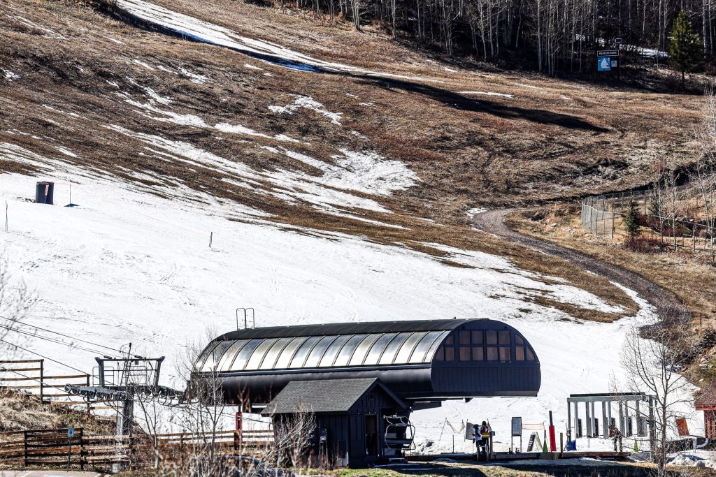
Austin Colbert/The Aspen Times
A cooldown is finally on the way after Colorado’s record-breaking weekend heat wave, but it won’t do much to save the dwindling snowpack and stave off early ski resort closures.
Several Western Slope mountain towns experienced record-breaking temperatures last week, with some towns logging the hottest day on record in up to 65 years. On average, most towns recorded temperatures between 20-30 degrees above normal, according to National Weather Service Meteorologist Brianna Bealo.
Aspen reached a high of 75 degrees on March 21, the hottest day of the heat wave, according to the National Weather Service. The previous record of 70 degrees was set in 1959, Bealo said.
Glenwood Springs was one of the warmest mountain destinations, reaching a high of 83 degrees on Saturday. The town’s previous record, set in 2004, was 73 degrees. Steamboat Springs’ record of 78 degrees surpassed a high of 64 recorded in 2017, though less historical data was available for comparison.
Higher-elevation mountain towns like Breckenridge and Vail saw temperatures near 68 and 70 degrees, respectively. Dillon in Summit County recorded a high of 70 degrees on March 21, almost 10 degrees hotter than the high of 61 degrees last recorded in 2004, according to National Weather Meteorologist Russell Danielson.

Support Local Journalism
“On average, it seems as though we broke our previous record highs by around 10 degrees that day,” Bealo said.
Snow showers, cold storms expected in April
Western Slope towns should expect the warmer weather to continue for the next week, followed by some relief in early April as long-term forecasts show possible showers and colder storms.
Tuesday through Thursday is forecast to bring more hot and sunny weather with highs near or in the 70s for lower-elevation valley towns like Glenwood Springs and Steamboat Springs, compared to highs in the 50s and 60s for towns like Aspen, Vail and Breckenridge.
Although the pattern will likely continue into the weekend, OpenSnow predicts that mountains near and east of the Continental Divide could see cooler temperatures and some snow on Friday morning as a cold front moves into eastern areas.
Beginning Sunday, March 29, some mountain resorts including Aspen, Vail and Breckenridge could see light rain and snow showers through March 31 due to moisture arriving from the southwest. Mountain towns themselves likely won’t see snow until April 1, with Vail and Breckenridge expected to see some snow showers, according to OpenSnow’s snow forecast.
Looking ahead, the first days of April should bring a return to cooler temperatures, with highs in the 40s and 50s for most Western mountain towns, with a few reaching into the 30s. There could also be continued chances for showers and perhaps a “real snowstorm” during the first 10 days of April, according to a Monday OpenSnow report.
Colorado snowpack sees rapid meltdown, resorts report early closures
Recent warm temperatures have meant early closures for some mountain resorts. Ski Cooper, Powderhorn Mountain and Sunlight Mountain resorts all closed for the season on March 22, with other resorts limiting terrain due to little natural snow. Other areas didn’t open at all, including Cranor Ski Area in Gunnison, Lee’s Ski Hill in Ouray and the Hesperus Ski Area.
The addition of another week of warmer temperatures spells bad news for Colorado’s rapidly dwindling snowpack. As of March 23, snow water equivalent in Colorado is at 44% of median with 16 days left to go until the median peak. The snowpack’s state will likely only get worse throughout the week thanks to the warm and dry weather.
Historically, the state’s snowpack reaches its peak in early April before the mountain snow drains away by June or July. A warm winter compared with early snowmelt, however, means the snowpack likely already reached its peak around March 10, Bealo said, and could melt out earlier in the spring.
“It looks like we’ve already reached peak, and we’re melting out pretty rapidly,” Bealo said. “Even though we’ve only really just started seeing melt-out occurring, if we continue at the same rate that we’re seeing, we’d probably be melted out somewhere towards the end of April, early May.”