Some Colorado mountain ski towns could see a snowy Christmas amid warm, dry forecast ahead
Colorado forecasters say some snow is possible for Colorado’s northern mountains on Dec. 18, but meaningful snow likely won’t arrive until around Christmas

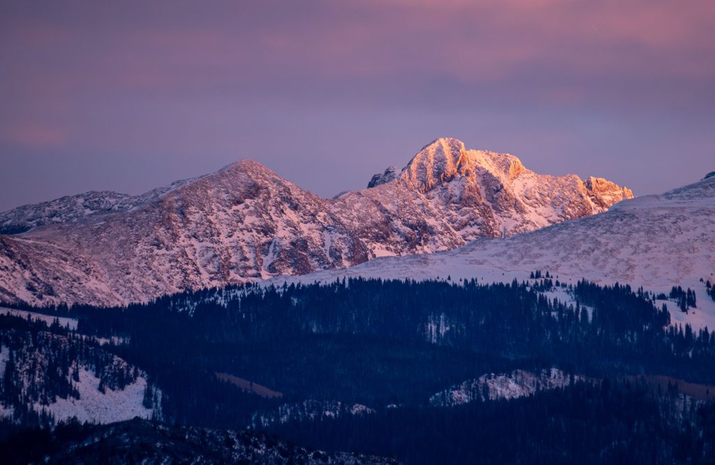
Ben Roof/Special to the Daily
Earlier this week, Colorado meteorologists all had the same question on their mind: Where is the snow?
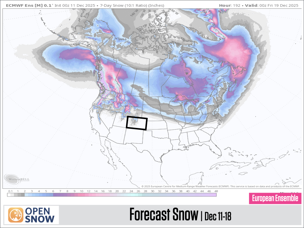
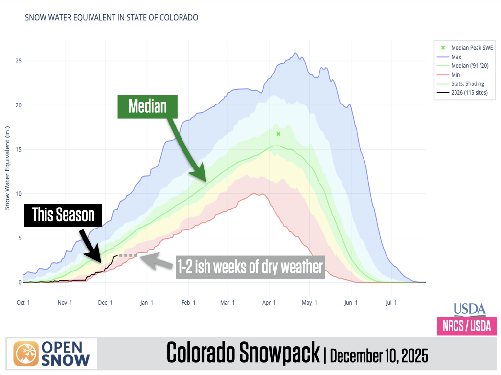
Following a two-day weekend storm that delivered 17 inches of new snow to Vail Mountain, the forecast shows little to no snow for the next two weeks. This is bad news for the state snowpack, which could quickly fall from over 50% of the median to near-record low levels for this time of year if no snow arrives through mid-December.
As of Thursday, OpenSnow is now pointing to Dec. 18 as a possible return for meaningful snowfall in the northern mountains, according to a Thursday OpenSnow report.
A storm track currently delivering snow to states well north of Colorado will spread across the Pacific Northwest throughout the week before heading southeast and delivering showers to the Midwest and Northeast. On or around Dec. 18, the storm track will pass close enough to Colorado to deliver some flakes to the northern and central mountains, according to the report.
The National Weather Service’s forecast is less confident about next week’s potential snow for the central mountains. Tom Renwick, a Grand Junction meteorologist for the National Weather Service, said any storms farther out than three days typically offer much less reliability.
Support Local Journalism
Renwick said the station’s sources aren’t currently showing many signs of snow in the central mountains for Dec. 18, but data from early next week will show a much clearer picture.
For now, chances look better for the northern mountains, but the forecast could still change in the week leading up to it.
“Right now, we actually have slightly better chances for snow next Wednesday versus next Thursday. The signal that far out isn’t terribly strong,” Boulder-based National Weather Service Meteorologist Zach Hiris said. “It does look like at least there’s a chance of some moisture working back in the northern half of the state.”
Between now and Dec. 18, Coloradans can expect dry weather and mostly sunny skies, with higher-than-normal temperatures in the 40s and 50s for the Western Slope, Renwick said.
“When you’re looking at the actual temperature anomalies, we’re generally in that 5-10 degrees above normal for most of the mountains,” Hiris said.
The northern mountains, which include Vail, Steamboat Springs and Breckenridge, have a slightly higher chance of seeing clouds and gusty winds.
“The good news is that the sun angle is low, so we shouldn’t lose much snow, but conditions could become firmer and/or crusty as we go through daily melt-freeze cycles on non-north-facing slopes,” OpenSnow Meteorologist Joel Gratz wrote in the report.
As of Dec. 11, Colorado’s snowpack is sitting at around 50-70% of the median. If the next one to two weeks bring less snowfall than expected, the statewide snowpack “might flirt with a record-low snowpack by late December,” according to OpenSnow.
“Our overall snowpack, in terms of exactly how much is out there, will pretty much flatline,” Hiris said. “The good news is that … we shouldn’t see a whole lot of loss to those higher-elevation snowpack sites.”
He added, “This is the time of year where we should be steadily adding snow up in the mountains. Seven more days of dry conditions would certainly get us a little bit lower than where we’re sitting right now.”
Despite the low amount of snow, a decent amount of ski terrain has been opened this week, with more openings planned in the next couple days, according to OpenSnow.
Longer-range forecasts suggest more meaningful snowfall might be possible for all Colorado mountains around Christmas Day. Despite being two weeks away, roughly 60% to 80% of the 51 European model versions show snowfall on Dec. 25, according to OpenSnow.
“For the busy holiday period starting around December 20, the most likely scenario is that a moderate amount of terrain will be open, with the chance for a significant amount of additional terrain opening during the final 5-6 days of December, IF the snow returns as the longer-range forecast shows,” Gratz wrote.
Hiris said that while the National Weather Service’s long-term forecast shows only potential for some snow around Christmas, it will likely bring a more sustainable weather pattern in which, instead of waiting for storms from neighboring northwestern states to scrape Colorado’s northern mountains, the state itself will develop a more active storm track.