Monsoonal rains slow Derby Fire spread as officials brace for new challenges with incoming storms

Sean Naylor Follow
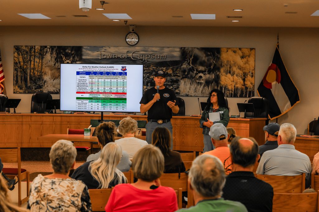
Chris Dillmann/Vail Daily
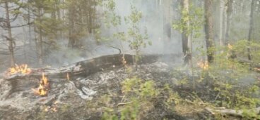
With multiple showers on Friday evening, the Derby Fire had no new reported growth Saturday. An Saturday afternoon post on The Derby Fire Facebook page said the fire was at 4,112 acres and 0% containment, the same numbers reported Friday evening by the National Interagency Fire Center.
However, the overnight storms provided minimal relief heading into a dry, windy Saturday, according to Incident Meteorologist Ryan Fliehman.
“We did get some measurable precipitation in a few places, but nothing widespread to where it would really totally change the conditions,” he said in a video update posted to the page shortly after, offering more optimism for precipitation in the long-term forecast.
“I think we are starting to move in the right direction to getting that traditional monsoonal pattern that we would expect late July, early August. It’s delayed a couple of weeks, but I do think we’re finally starting to see that traditional pattern here in the western portions of Colorado,” he said.
However, the monsoon rains come with their own set of concerns for the firefighters.

Support Local Journalism
“The bad news with this is it is a monsoonal push. So we do continue to have that chance for gusty outflow winds up to 35 miles an hour and also a good chance for lightning,” he said.
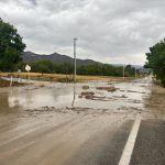
With the wind and lightning causing fire concerns, heavy moisture can also cause flash flooding and debris flow from the burn scars, making the monsoons hard to predict and full of hazards.
“We’re really going to have to change from the near-critical fire weather conditions of the past to this potential for the debris flows and localized flash flooding,” Fliehman said.
Fire personnel pour in
There are 378 personnel working the fire as of Saturday, along with air resources, bulldozers and fire engines.
The Derby Fire is the top priority fire in the country for needing resources, according to public information officer Stefani Spencer, partially due to the fire’s proximity to communities and its growth pattern.
“They also look at the probability of success,” Spencer said Friday of the national ranking system. “If we get these, how probable are we to have success in meeting the objective, which is to protect public land.”
According to a Derby Fire Information email update Saturday afternoon, winds have begun to push the Derby Fire south towards the Sweetwater Canyon area.
“Crews have worked to protect over 350 structures by positioning sprinkler kits and removing surrounding fuels,” the update reads. “Other firefighters have constructed about 3 total miles of dozer and hand lines along the fire’s southern perimeter using existing roads to connect them and form control lines. Aircraft are supporting firefighting efforts by dropping water and flame retardant along the west flank.”
Crews have taken advantage of the slowed spread by making progress building fire lines.
“They’ve been able to find a way to go direct on the fire,” Philip Knaub, operations section chief, said. “And when I say direct, we have two methods. We have a direct line and we have an indirect line. Our direct line is when we build fire line right on a fire’s edge … and the benefit of going direct is it removes the possibility for that fire to grow anymore beyond that line that is put in.”
The fire had three helicopters providing air support as of Friday, but one of the helicopters assigned to the fire was involved in a crash Friday afternoon that remains under investigation, according to the U.S. Forest Service.
There is an unconfirmed report that the helicopter is in a lake 13 miles northwest of the airport, according to the Forest Service’s release on the incident. The pilot was picked up by another aircraft and flown to the airport. Local emergency medical personnel checked the pilot, who had minor bumps and bruises and desired no further medical attention.
The National Transportation Safety Board has been notified of the incident, but it is unknown whether it will respond. The Forest Service said A USDA Forest Service investigation team is on its way to Eagle County to investigate.
While resources are requested and managed by the Northern Rockies Complex Incident Management Team 3, local crews from Eagle River Fire Protection District, Vail Fire Department and Eagle Valley Wildland are assisting with the firefighting effort.
Colorado River Road, forest closures extended
A closure of Colorado River Road was extended Friday evening all the way south to the roundabout in Dotsero. The closure runs through Red Dirt Creek Road southwest of Burns. Eagle County Sheriff James van Beek said he extended the closure out of an abundance of caution for fire crews in the area and residents.
Areas along the Colorado River Road have been moved to pre-evacuation status. Anyone who will take longer to evacuate, such as those with pets or livestock, should leave now.
Saturday, White River National Forest also expanded the public closure to the southwest, including the area from southwest of Sweetwater Lake to the west rim of Deep Creek Canyon. A map and detailed description of the closure, including affected roads and trails, are available at USDA.gov.
Vail Daily editor Nate Peterson contributed reporting