Snow returns to Colorado’s mountains this week, but wind and warmth limit accumulation

John LaConte/Vail Daily
After an unusually warm start to the week, a midweek storm is forecast to bring light snowfall and strong winds to Colorado’s northern and central mountains, though forecasters say it won’t do much for the state’s lagging snowpack.
Monday and Tuesday of this week were abnormally warm for December, with temperatures in the 30s and 40s. Wednesday night is expected to bring some relief from the dry weather to the northern and central mountains, though pairing winds mean mountain towns might not see much accumulation.
“Unfortunately, with how warm things are and how little accumulation there is … it’s not really going to build too much on the snowpack,” said Braeden Winters, a Grand Junction meteorologist with the National Weather Service. “When we’re talking about an entire season, this really just kind of feels like a drop in the bucket.”
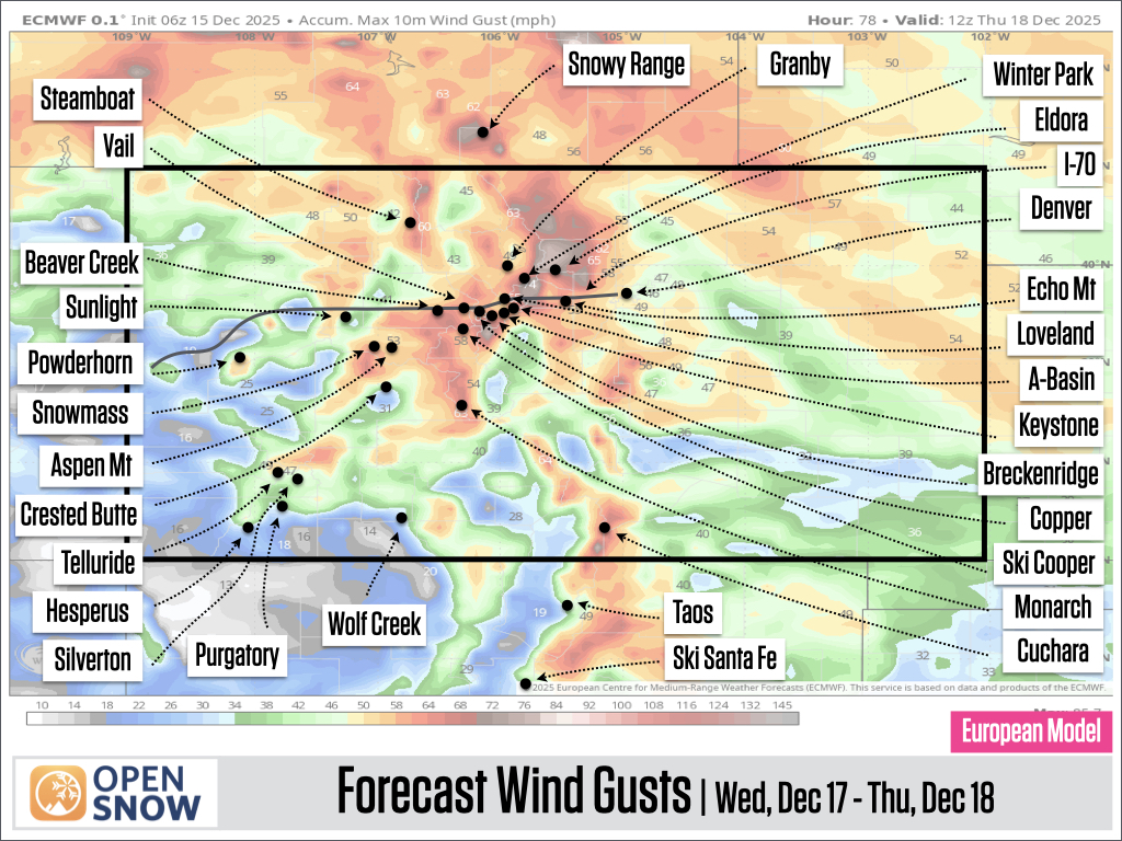
Snowfall will begin Wednesday afternoon and continue through Wednesday night or early Thursday morning, with most snow falling over the northern and central mountains, according to a Tuesday report from OpenSnow.
While forecasters are projecting around 1 to 6 inches of accumulation, accompanying gusty winds could make it difficult to measure the exact amount.
Support Local Journalism
The storm’s winds are expected to last from Wednesday afternoon through Thursday morning, with gusts measuring between 40 and 80 miles per hour from the mountains into the plains, according to the report.
The combination of snow and wind will likely limit visibility and result in icy road surfaces on Wednesday evening, especially on northern mountain roads. Drivers traveling over the higher passes are encouraged to plan for extra travel time.
“We could get some white snow along I-70, especially up near Vail pass, but it’s only a matter of a few inches,” Winters said. “Whenever you get any snow, you have that possibility of slick roads, especially over the mountain passes, but … there’s nothing really too crazy that we’re expecting to see.”
The northern mountains could see some additional light snow on Friday, Saturday and Sunday, with minimal snow accumulation. Snow totals from Wednesday through Sunday are projected to be between 3 and 10 inches for the region.
Along the I-70 corridor, snow totals for the weekend will be closer to 2 to 6 inches, according to OpenSnow estimates.
Cooler temperatures this week will bring mountain towns into the 20s, before mild temperatures are expected to return into the week of Christmas.
“Up in the mountains, we’re still talking 5 to 10 degrees above normal,” Winters said. “There’s supposed to be a little bit of a cool down over the next few days, but even then, we’re still expected to stay a handful of degrees above normal basically throughout the entire week.”
As far as the snowpack goes, it’s a mixed bag. Colorado’s statewide snowpack sits between 50% and 70% of average as of Dec. 16, which won’t see much change from Wednesday’s storm due to the lighter accumulation and the accompanying strong winds.
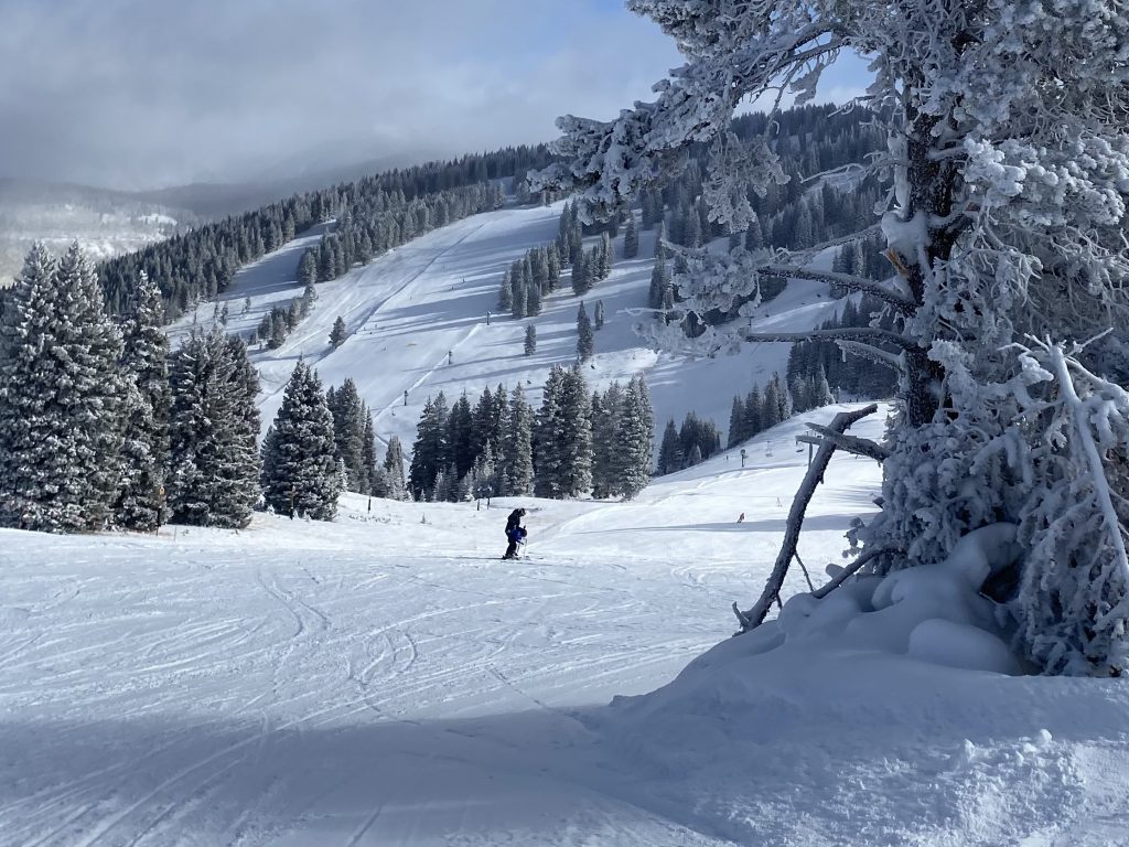
While a few ski areas have had more luck in opening terrain since the beginning of the year, the majority are still between 5% and 20% open, according to OpenSnow. Thursday morning will be the best day to enjoy some soft snow, though it will likely “be groomed by Thursday morning” thanks to strong winds blowing the snow around throughout the night.
Beyond weekend snow to the northern mountains, weather for Dec. 22 through Dec. 24 will be mostly dry. Storms to the north and west of Colorado could “swing across the Rockies” from Dec. 25 to Dec. 29, but snow is not guaranteed.